Fond de carte
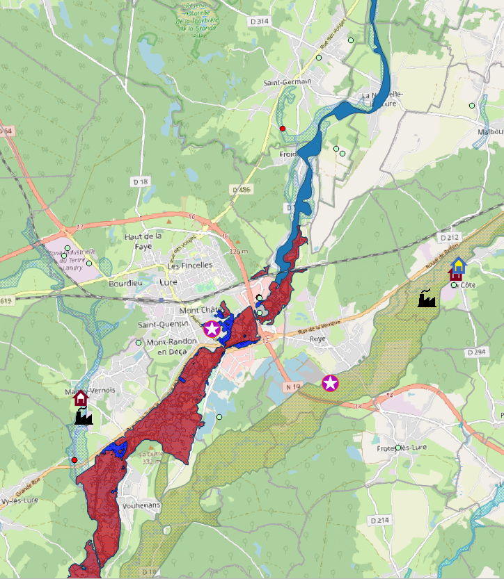
- Titre
- Référent Départemental Inondation (RDI)
- Description
- Carte synthétique recensant zones inondables, infrastructures, bâtiments et certains ERP. Données mises à jour au fil de l'eau. Carte réalisée en 2021.
- Structure
- DDT 70
- Personne
- DDT-PRGC
- Projection
- EPSG:2154
- Emprise
- 862379.35825278889387846, 6681963.65684014745056629, 990472.27680297405458987, 6775851.92684014700353146
- Service WMS
- WMS Url
- WMTS Url